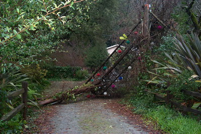
| First things first: we weren't even close to flooding. We weren't even in the warning stage. And nothing blew away, or over. Well, nothing on our property -- the arch over the dirt road next door blew down though: | |
 |
|
| So we're fine. If anyone worried at all, we thank you for your concern, but this wasn't one to be concerned about. Here's some edifying graphics to help determine when it's time to panic for us | |
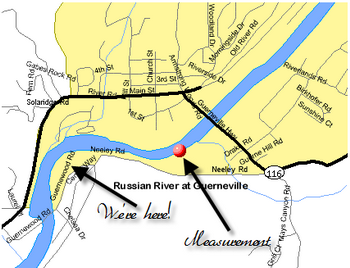
NOAA's website has a wonderful riverwatch section. This is where their measurement sensor is in relation to where we are
|
 |
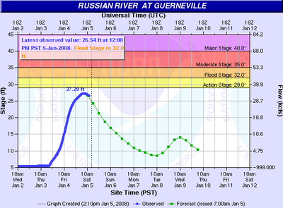
From the graph at right, you can see that we missed the poorly-named "Action stage" -- we refer to it as "Warning Stage," thank you very much. But it is important to note just how fast the river went up. The graph is pretty much flat until around January 4th. From there it went up over twenty feet in a very short period of time. The predicted drop, as you can see, is pretty quick, too, but rains next week will still have an impact because the ground is saturated. So what does this look like? |
 |
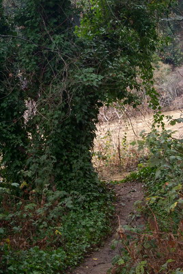 |
If you have walked with us on the path next to the house down through the ivy and blackberry bushes down to the wide beach at the river, then this picture has a bit of context. Just beyond the tree the path opens up to the beach. Now it is the beach. |
This is taken from just beneath the tree looking out across the river |
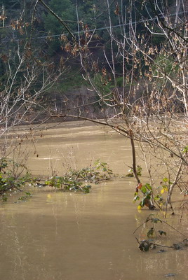 |
Again, looking across the river. If you've been down to the edge of the river in the summertime, you've inevitably looked up at the road running along the river. The text on the picture is where the road is, which should give you a little perspective on the relative height of the river. |
|
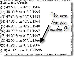
Again from the NOAA page, they list the Top Ten historical crests. I know Lana and Gary have nightmares about a number of the dates on the list. For us, our little flood back in 2006 made the top 10! One other thing from the list, you can see from numbers 1, 5, and 10 that while we're in absolutely no danger right now, the rainy season on the river has really just started. |
 |
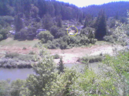
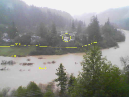
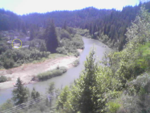
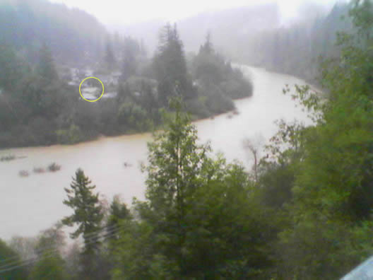
I dug these pictures out of the Sluglife archive, and I apologize for the quality -- theflood pictures were taken on the only digital camera we had at the time which was the camera on my (then brand new) cell phone. The top picture was taken in the summertime from the overlook well above River Road. It's quite a nice little overlook and gives great perspective on our little floodplain. The bottom picture was taken on December 12/30/05 at about 4:15pm (according to the timestamp), this was the calm before the next storm which would take the river up to, well, 41.45 as the Top Ten indicates. |
 |
 |
|
One more set of pictures from the same overlook, but looking a bit further downriver. |
 |
 |
|
But that was then, and this is now -- our little home is a bit soggy, but nicely high and dry. |
 |
About |
History |
RSS |
Index
Links We Think Are Cool
« Shurik Esq. Auditions for Mutual of Omaha’s “Wild Kingdom” | Main | January! New Banner!! »
Nice storm! We're still here! :)
Search
About
This page contains a single entry from the blog posted on January 5, 2008 5:16 PM.
The previous post in this blog was Shurik Esq. Auditions for Mutual of Omaha’s “Wild Kingdom”.
The next post in this blog is January! New Banner!!.
Many more can be found on the main index page or by looking through the archives.

Powered by
Movable Type 3.31
Movable Type 3.31